 Recently Willem and I spent a lovely Sunday afternoon in Texel, an area of the Netherlands neither of us had previously visited. Texel (pronounced Tessel in Dutch) is an island in the province of North Holland. It is the most populated of the Frisian Islands, and is situated between the North Sea to the west and the Wadden Sea to the east.
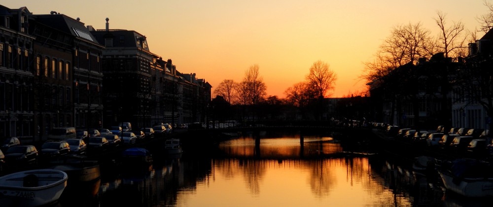
To get there, we drove from Haarlem to Den Helder, where we took the ferry across the channel to the island. The ferry is the only way to get to the island from the mainland, and while it is not cheap (18 euros for the car), it is fast and comfortable. The ferry, operated by TESO, leaves every hour from Den Helder and the journey only takes 20 minutes. We were lucky enough to arrive right as the ferry was about to depart, so we drove right up and onto the ship.

During the summer months, however, we read that the island is extremely popular with campers and beach-goers; a long wait for the ferry on a hot, summer day is not unheard-of. On board the ferry there were plenty of snacks and drinks for sale, a souvenir stall (I bought some nice postcards there), and plenty of clean, free (yay!) toilets. When we got to the island, we followed the signs straight to De Cocksdorp at the northern tip of the island, where the Texel Lighthouse is located.


For three euros, you can climb the 45 meters to the top of the lighthouse (fun fact: lighthouses are called vuurtoren in Dutch, meaning “fire towers”, because lighthouses were kept lit by fires in the days before electricity), where you are rewarded with amazing vistas of the beach and sea on three sides. You don’t have to climb very high to get impressive views in the Netherlands!
On our tour of the lighthouse we learned that the Texel Lighthouse was also the site of a very strange and interesting historical event during WWII: the Georgian Uprising of Texel (Opstand der Georgiers). During the war, Texel formed part of the German Atlantic Wall system of defense. By late in the war, however, the German forces were occupied with fighting in France and they had to find creative ways of holding their territory along the Atlantic Wall. Texel Island was occupied by a battalion of captured soldiers from the Georgian Soviet Socialist Republic (modern day Georgia) on the Eastern front who had been given the choice of being sent to POW camps or fighting in the Germany army when they were captured.

Georgian soldiers in the Germany army
In April 1945, the Georgian soldiers, aided by the Dutch resistance on the island, revolted against their German commanders. The Georgians quickly gained control of the tiny island, but were unable to hold it when German reinforcements arrived. Over the next five weeks, the Germans systematically combed the island for any of the Georgian rebels. A group of the Georgians took refuge in the last available stronghold on the island, which was the Texel lighthouse. Even though the Germans officially surrendered on May 5, 1945, the fighting on Texel Island continued until May 20, leading the uprising to be called “Europe’s last battlefield”. In total, 565 Georgians, 120 citizens of Texel, and around 800 Germans lost their lives during the uprising.
The lighthouse itself was heavily damaged during the fighting. After tests, it was found that the structural integrity of the lighthouse had been compromised by the sustained gunfire it had come under, so an entirely new exterior was built around the old lighthouse. Visitors to the lighthouse today can walk in between the two walls on a section about halfway up the lighthouse to see the original damage done by mortar shells and gunfire.

This was the most fascinating part of the lighthouse, in my opinion. It is scary to imagine how desperate the Georgian soldiers must have felt watching the Germans advance towards them while they were trapped in the lighthouse at the very tip of the island. There is also a Georgian cemetery and memorial on Texel that are open to the public for those interested in military history.
After visiting the lighthouse, we took the rest of the day to drive around the various towns on the island. Below are some of the wacky things we learned about Texel Island on our drive. For such a small place, it sure is an island full of things to discover!
Two Islands- The modern-day Texel Island actually used to be two different islands, Texel and Eierland. The two were separated by a single small channel. In the 17th century, the two islands were poldered together, creating a single landmass that is now the largest natural land barrier between the North Sea and the Wadden Sea.
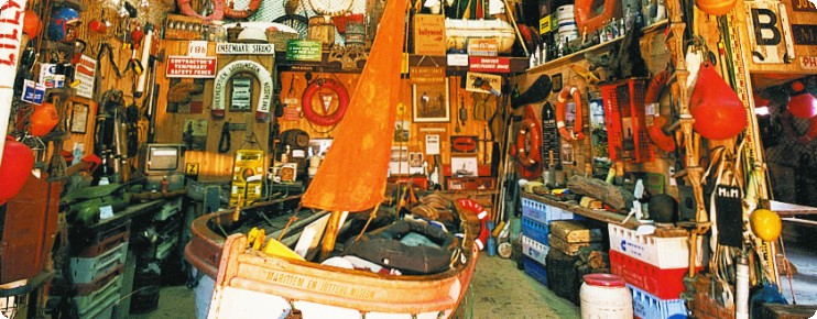
Beachcomber madness- Texel has a centuries-old history of beachcombing. The particular mix of currents, tides, and winds that constantly batter the island result in a whole lot of debris being washed up on the island every day. In the old days, when ships wrecked off the coast of the island during storms, the islanders would come out by the hundreds to collect the materials that washed up on shore. Beachcombing is such a tradition here that there are multiple Jutter museums (Jutter meaning “wreckage” or “debris” in the West Frisian dialect) dedicated solely to displaying the countless items found on Texel’s shores.
Naval infamy- Texel Island is used today as a training area for the Dutch Navy, but it is also the site of one of the most embarrassing moments in Dutch naval history. In 1795, Texel became the only place in history where an entire navy was defeated on horseback. How is this possible, you ask? Well, the French army was fighting the Netherlands at the time, and received word that the Dutch navy was stuck in ice frozen around the island. Upon hearing this, the French Commandant, Louis Joseph Lahure, simply rode up to the Dutch ships with 128 of his men and demanded their surrender. Having no other choice, the Dutch were forced to surrender without a single shot being fired. (I found this hilarious. Willem…not so much.)

Tuunwallen (“Garden walls”) and sheep sheds– Driving around Texel, it is clear that there are many times more sheep than people on this little chunk of land in the Wadden Sea. The pastures where Texel sheep graze are unique to the island. Instead of fences, the edges of the fields are traditionally delineated by earthen walls made up of piled turf and vegetation, called tuunwallen. The sheep shelters on Texel are also uniquely designed for the conditions on the island. From afar, the sheds look like strange houses that have been chopped in half. They are designed in this manner, with the entry on the flat side and always facing the northeast, because the harsh winds that blow constantly across the island come from the southeast.


We had a great time exploring the island. It reminded me a lot of my trips to the Outer Banks of North Carolina as a kid. Now, if only the finicky Dutch weather would warm up so we could actually swim in the water on one of these little visits to the sea!
